
ToolMage
Sign in

Best 1 Lidar Systems AI tools for Perception

Popular Lidar Systems AI tools in Perception include Unitree, helping you work more efficiently.

Unitree
Paid

Unitree

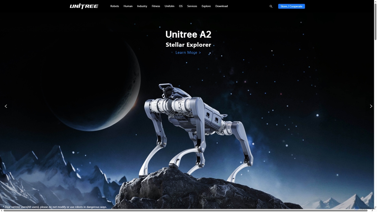
Unitree is a world-renowned robotics company specializing in the R&D, production, and sales of high-performance legged and humanoid robots, robotic arms, and advanced perception systems like 4D LiDAR. They offer innovative solutions for consumer, industrial, and research applications globally.

Personal Robotics
Visits 616.2KFavorites 126Likes 157

About Lidar Systems

Lidar Systems are advanced AI-powered tools that utilize pulsed laser light to measure distances and generate highly accurate 3D representations of environments. These systems emit laser beams and calculate distances based on the time it takes for the light to return, creating dense point clouds. They are fundamental for applications requiring precise spatial awareness, such as autonomous navigation, detailed environmental mapping, and robotics. Their ability to operate effectively in various lighting conditions makes them a critical component in robust perception solutions.

Core Features

  • 3D Point Cloud Generation: Captures millions of data points to form a detailed three-dimensional model of surroundings.
  • Precise Distance Measurement: Accurately calculates distances to objects, enabling high-fidelity mapping and obstacle detection.
  • Real-time Environmental Mapping: Provides instantaneous spatial data for dynamic environment understanding and navigation.
  • Environmental Robustness: Operates effectively in diverse lighting conditions, including low light, fog, and rain.
  • Object Detection & Tracking: Identifies and monitors the movement of objects within the scanned area for situational awareness.

Applicable Scenarios

Lidar Systems are indispensable in fields where accurate spatial data is paramount. Autonomous vehicles rely on them for safe navigation and obstacle avoidance. Robotics leverage Lidar for precise indoor and outdoor movement and interaction. Urban planners and surveyors use Lidar for creating detailed city models and topographic maps, aiding in infrastructure development and environmental analysis.

How to Choose

When selecting a Lidar System, consider its range and accuracy, which dictate the effective operational distance and precision of measurements. Evaluate the field of view (FoV) to ensure adequate coverage for your application. Data output format and processing capabilities are crucial for integration with existing AI perception pipelines. Also, assess environmental robustness (e.g., resistance to adverse weather) and the overall cost, including hardware and software.

Lidar Systems use cases

1

Autonomous Vehicle Navigation and Obstacle Avoidance

Automotive engineers integrate Lidar Systems into self-driving cars to generate real-time 3D maps of their surroundings. This enables precise detection and classification of pedestrians, other vehicles, and road infrastructure, even in challenging lighting conditions. The Lidar data feeds into AI perception modules, allowing the vehicle to safely navigate, plan paths, and avoid collisions with high accuracy, significantly enhancing safety and reliability.

2

Robotics for Industrial Automation and Logistics

Manufacturers and logistics companies deploy robots equipped with Lidar Systems for precise indoor and outdoor navigation. These robots can autonomously map complex factory floors or warehouses, detect dynamic obstacles like forklifts and personnel, and perform tasks such as automated material handling or inspection. Lidar ensures robust operation in environments where GPS is unavailable or visual conditions are poor, optimizing efficiency and safety in automated workflows.

3

High-Precision Topographic and Urban Mapping

Surveyors, geographers, and urban planners utilize airborne or terrestrial Lidar Systems to generate highly accurate digital elevation models (DEMs) and digital surface models (DSMs). This data is crucial for detailed land management, infrastructure planning, flood modeling, and environmental monitoring. Lidar's ability to penetrate vegetation to map the bare earth surface provides unparalleled detail for complex terrain analysis, supporting informed decision-making in various geospatial applications.

4

Forestry and Agriculture Management

Foresters and agricultural scientists employ Lidar Systems to gain detailed insights into vegetation structure. In forestry, Lidar helps assess tree height, canopy density, biomass, and forest health, aiding in sustainable forest management and timber volume estimation. In agriculture, it assists in precision farming by mapping terrain, optimizing irrigation, monitoring crop health, and identifying areas requiring specific treatment, leading to improved yields and resource efficiency.

5

Infrastructure Inspection and Maintenance

Engineers and infrastructure managers use Lidar Systems for detailed inspection and monitoring of critical assets like bridges, roads, railways, and power lines. By generating precise 3D models, Lidar can detect subtle deformations, wear and tear, or structural anomalies that might be missed by traditional methods. This enables proactive maintenance, reduces inspection time, and enhances safety by identifying potential issues before they become critical failures, optimizing asset lifespan.

6

Archaeological Site Mapping and Preservation

Archaeologists employ Lidar Systems, often airborne, to map vast landscapes and uncover hidden ancient structures or features beneath dense vegetation. The Lidar's ability to penetrate tree canopies allows for the creation of detailed topographic maps of the bare earth, revealing subtle changes in elevation that indicate human activity. This non-invasive method significantly speeds up the discovery process and aids in the preservation and study of archaeological sites without disturbing them.

Lidar Systems FAQ

What are Lidar Systems?

Lidar Systems are advanced remote sensing technologies that use pulsed laser light to measure distances and create highly accurate 3D representations of objects and environments. They work by emitting laser pulses and calculating the time it takes for the light to return, generating dense point clouds that provide precise spatial data. These systems are crucial for applications requiring detailed spatial awareness, such as autonomous navigation, mapping, and environmental monitoring, offering robust performance across various lighting conditions.

How do Lidar Systems differ from traditional cameras in AI perception?

Lidar Systems measure distance directly by emitting laser light, providing accurate 3D depth information regardless of ambient lighting conditions. Traditional cameras capture 2D visual data (color and texture) and infer depth, which can be challenging in low light or with ambiguous textures. Lidar excels in precise spatial mapping and obstacle detection, while cameras provide rich semantic information for object classification and scene understanding. They are often used complementarily in AI perception to leverage their respective strengths.

What are the key factors to consider when choosing a Lidar System?

When selecting a Lidar System, consider its range and accuracy, which dictate the effective operational distance and precision of measurements. Evaluate the field of view (FoV) to ensure adequate coverage for your application. Data output format (e.g., point cloud density, reflectivity) and processing capabilities are crucial for integration with existing AI perception pipelines. Also, assess environmental robustness (e.g., resistance to adverse weather, dust, vibration) and the overall cost, including hardware, software, and maintenance.

What are the primary applications of Lidar technology?

Lidar technology is widely applied in various fields. In autonomous vehicles and robotics, it enables precise navigation, obstacle detection, and collision avoidance. For mapping and surveying, it generates detailed topographic and urban models. Environmental monitoring uses Lidar for forestry, agriculture, and coastal mapping. Additionally, it's employed in smart infrastructure for inspection, security and surveillance for perimeter monitoring, and even archaeological exploration for uncovering hidden structures.

How do Lidar Systems contribute to AI-powered perception?

Lidar Systems provide AI perception with fundamental 3D spatial data, which is critical for understanding the physical world. By generating precise point clouds, Lidar allows AI algorithms to accurately detect, classify, and track objects, measure distances, and build detailed environmental maps. This robust spatial input enhances the AI's ability to navigate, make informed decisions, and interact safely within complex real-world environments, especially where visual data alone might be insufficient or unreliable due to lighting or occlusion.

What are the limitations of Lidar Systems?

While powerful, Lidar Systems have certain limitations. They can be significantly affected by adverse weather conditions like heavy rain, snow, or dense fog, which can scatter laser beams and reduce accuracy or range. Lidar sensors are generally more expensive than cameras, impacting overall system cost. Additionally, Lidar data primarily provides geometric information (shape and depth) but lacks color and texture, often requiring fusion with camera data for comprehensive scene understanding in AI perception.