Nijimap
Nijimap is an AI-powered event discovery and navigation platform for Malaysia, specializing in Anime, Comics, and Games (ACG) …
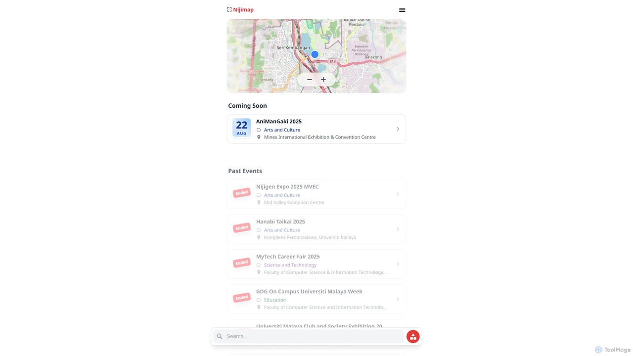
Nijimap is an AI-powered event discovery and navigation platform for Malaysia, specializing in Anime, Comics, and Games (ACG) conventions, cultural festivals, and tech fairs. It enhances the event-goer's experience with real-time, community-driven data on crowd levels, parking, and interactive venue maps.
About Maps & Navigation
AI-powered Maps & Navigation tools are a category of sophisticated applications designed to enhance spatial understanding, route optimization, and location-based services. These tools leverage advanced AI algorithms, including machine learning and computer vision, to process vast amounts of geographic data, real-time traffic information, and user preferences. They provide dynamic route planning, predictive insights, and personalized navigation experiences, making travel and logistics more efficient and intelligent. As a vital component of modern travel, these tools transform how we explore, plan journeys, and manage location-dependent operations.
Core Features
- Intelligent Route Optimization: Dynamically calculates the most efficient paths considering real-time traffic, road conditions, and user-defined waypoints.
- Location Intelligence & Geocoding: Analyzes spatial data, converts addresses to precise geographic coordinates, and provides insights for business and urban planning.
- Predictive Traffic Analysis: Forecasts congestion patterns and suggests optimal travel times or alternative routes to avoid delays.
- Personalized Navigation: Tailors routes, points of interest, and recommendations based on individual user history, preferences, and accessibility requirements.
- 3D Mapping & Visualization: Offers immersive, detailed three-dimensional representations of environments for enhanced exploration and planning.
Use Cases
These tools are indispensable for various sectors, from personal travel to complex enterprise operations. Logistics companies utilize them for optimizing delivery routes, reducing fuel consumption and delivery times. Urban planners employ them to simulate traffic flows and pedestrian movements for infrastructure development. Individual travelers benefit from personalized itineraries and real-time guidance, making exploration seamless and enjoyable.
How to Choose
When selecting an AI Maps & Navigation tool, consider its data accuracy and real-time update capabilities for maps, traffic, and points of interest. Evaluate its integration capabilities with existing systems like fleet management or travel platforms. Look for customization options and API access if specific business needs or developer integration are required. Finally, assess the user interface and overall user experience for intuitive navigation across different devices.
Maps & NavigationUse Cases
Optimizing Multi-Stop Delivery Routes
Logistics and delivery companies utilize AI Maps & Navigation tools to analyze real-time traffic, vehicle capacity, and delivery windows. These tools generate the most efficient multi-stop routes, dynamically adjusting for unforeseen delays. This significantly reduces fuel costs, shortens delivery times, and improves overall operational efficiency for fleet managers.
Simulating Urban Traffic & Pedestrian Flows
Urban planners and city developers leverage AI navigation tools to simulate complex traffic patterns, pedestrian movement, and public transport usage within urban environments. This capability is crucial for designing new infrastructure, optimizing existing road networks, and planning smart city initiatives that enhance urban mobility and livability.
Creating Personalized Travel Itineraries
Individual travelers can use AI Maps & Navigation tools to generate highly personalized travel itineraries. Based on their interests, budget, and preferred pace, the tools suggest optimal routes, attractions, dining options, and accommodations. They adapt to real-time conditions like weather or unexpected closures, ensuring a smoother and more enjoyable journey.
Analyzing Location Data for Property Development
Real estate developers and investors employ location intelligence from AI maps to assess potential property values, analyze demographic data, evaluate proximity to amenities, and understand accessibility. This data-driven approach aids in strategic site selection, market analysis, and identifying optimal locations for new residential or commercial projects.
Enhancing Emergency Route Planning & Response
Emergency services, including ambulances, fire departments, and disaster relief teams, rely on AI-powered navigation to identify the fastest and safest routes to incident locations. These tools consider real-time road closures, traffic congestion, and even terrain, enabling rapid response during critical emergencies and improving life-saving operations.
Identifying Optimal Retail Store Locations
Retail businesses and franchises utilize AI Maps & Navigation tools to analyze customer demographics, competitor locations, and foot traffic data. By understanding spatial market dynamics, they can identify the most strategic and profitable locations for new stores, pop-up shops, or service centers, maximizing market penetration and sales potential.